Garikhana morning sale 19200 ac 4/ non 22
Saturday, September 4, 2021
Wednesday, August 18, 2021
Padma River

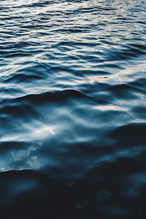
The Padma or Podda (Bengali: পদ্মা Pôdda) is a major river in Bangladesh and India (downstream of Giria). It is the main distributary of the Ganges, flowing generally southeast for 120 kilometres (75 mi) to its confluence with the Meghna River near the Bay of Bengal.[1] The city of Rajshahi is situated on the banks of the river.[2] However, over 660 square kilometres (256 sq mi) of land, has been lost due to erosion of Padma since 1966.[3]

Padma River
পদ্মা নদী
(পূর্বনাম:কীর্তিনাশা)
Padma River in Bangladesh
Padma River in Bangladesh
Location
Countries
Bangladesh, India (as Ganges)
Location
Murshidabad and Malda districts in India. Munshiganj, Nawabganj, Manikganj, Rajshahi, Pabna, Kushtia, Faridpur, Rajbari, Shariatpur, and Chandpur Districts in Bangladesh
Physical characteristics

Source
• location
Bifurcation of the Ganges at Giria, India, and The Gangotri Glacier in the middle of Himalayans
Mouth

• location
Bay of Bengal
Length
120 kilometres (75 mi)[1]
Discharge
• average
Annual average:
35,000 m3/s (1,200,000 cu ft/s)
During monsoon season:
750,000 m3/s (26,000,000 cu ft/s)
During dry season:
15,000 m3/s (530,000 cu ft/s)
Basin features
River system
Ganges River System

A map showing the major rivers that flow into the Bay of Bengal, including Padma.
History Edit
Etymology Edit
The Padma, Sanskrit for lotus flower, is mentioned in Hindu mythology as a byname for the Goddess Lakshmi.[4]
The name Padma is given to the lower part of the course of the Ganges (Ganga) below the point of the off-take of the Bhagirathi River (India), another Ganges River distributary also known as the Hooghly River. Padma had, most probably, flowed through a number of channels at different times. Some authors contend that each distributary of the Ganges in its deltaic part is a remnant of an old principal channel, and that starting from the westernmost one, the Bhagirathi (in West Bengal, India), each distributary to the east marks a position of a newer channel than the one to the west of it.
Geographic effects Edit
Padma River and boats (1860)
Eighteenth-century geographer James Rennell referred to a former course of the Ganges north of its present channel, as follows:
Appearances favour very strongly the opinion, that the Ganges had its former bed in the tract now occupied by the lakes and morasses between Nattore and Jaffiergunge, striking out of the present course at Bauleah ... to a junction with the Burrampooter or Megna near Fringybazar; where the accumulation of two such mighty streams probably scooped out the present amazing bed of the Megna.[5]
The places mentioned by Rennell proceeding from west to east are Rampur Boali, the headquarters of Rajshahi district, Puthia and Natore in the same district and Jaffarganj in the district of Dhaka. The place last named were shown in a map of the Mymensingh district dated 1861, as a subdistrict (thana) headquarters, about 10 kilometres (6 mi) south-east of Bera Upazila police station. It is now known as Payla Jaffarganj and is close to Elachipur opposite Goalunda. According to Rennell's theory, therefore, the probable former course of the Ganges would correspond with that of the present channel of the Baral River.[citation needed]
Authorities agree that the Ganges has changed its course and that at different times, each of the distributaries might have been the carrier of its main stream.[citation needed]
The bed of the Padma is wide, and the river is split up into several channels flowing between constantly shifting sand banks and islands. During the rains the current is very strong and even steamers may find difficulty in making headway against it. It is navigable at all seasons of the year by steamers and country boats of all sizes and until recently ranked as one of the most frequented waterways in the world. It is spanned near Paksey by the great Hardinge Bridge over which runs one of the main lines of the Bangladesh Railway.[citation needed]
Hardinge Bridge in Bangladesh
Geography Edit
The Padma enters Bangladesh from India near Nawabganj and meets the Jamuna (Bengali: যমুনা Jomuna) near Aricha and retains its name, but finally meets with the Meghna (Bengali: মেঘনা) near Chandpur and adopts the name "Meghna" before flowing into the Bay of Bengal.
Rajshahi, a major city in western Bangladesh, is situated on the north bank of the Padma.
The Ganges originates in the Gangotri Glacier of the Himalaya, and runs through India and Bangladesh to the Bay of Bengal. The Padma enters Bangladesh at Shibganj in the district of Chapai Nababganj. The Ganges branches into two distributaries, the Hooghly and the Padma at Giria in Murshidabad district of India . The Hooghly River, which continues southwards in India is also known as the Ganga(traditionally) and Bhagirathi.
Further downstream, in Goalando, 2,200 kilometres (1,400 mi) from the source, the Padma is joined by the Jamuna (Lower Brahmaputra) and the resulting combination flows with the name Padma further east, to Chandpur. Here, the widest river in Bangladesh, the Meghna joins the Padma, continuing as the Meghna almost in a straight line to the south, ending in the Bay of Bengal.
Sunset from Padma River
Pabna District Edit
A view of Padma river in summer near Rajshahi
The Padma forms the whole of the southern boundary of the Pabna District for a distance of about 120 kilometres (75 mi).
Kushtia District Edit
The Jalangi River is thrown off at the point where the mighty Padma touches the district at its most northernly corner, and flows along the northern border in a direction slightly southeast, until it leaves the district several kilometres to the east of Kushtia. It carries immense volumes of water and is very wide at places, constantly shifting its main channel, eroding vast areas on one bank, throwing chars on the other, giving rise to many disputes as to the possession of the chars and islands which are thrown up.
Murshidabad District Edit
Murshidabad District situated on the western bank of The Padma. It flows dividing the Rajshahi and Murshidabad District of West Bengal and created a natural river border between India and Bangladesh.[6][7] Jalangi area of the district was seriously affected by River bank erosion of Padma.[8]
Rajshahi District Edit
Rajshahi is the largest city among the cities which is situated on the bank of Padma river. It is the third largest city in Bangladesh. It is a major city in the north Bengal. Rajshahi has a decorated embankment of Padma. Rajshahi Collegiate School is one of the oldest schools in Indian Subcontinent, situated on Padma river bank. The school was endangered three times by the disintegration of the Padma river. Padma Food Garden, A.H.M. Kamaruzzaman Central Park and Zoo, Barokuthi Nandan Park, Muktamancha, and 'T' shaped embankment (Bengali: টি বাঁধ) are best tourist spot in Rajshahi which are situated on the bank of Padma river.
Sunset from the river Padma during monsoon, Rajpara, Rajshahi
Infrastructure Edit
Sky over river padma
Damming Edit
After the construction of the Farakka Barrage on the Ganges River in West Bengal, the maximum flows in the Padma River were reduced significantly. The flow reduction caused many problems in Bangladesh, including the loss of fish species, the drying of Padma's distributaries, increased saltwater intrusion from the Bay of Bengal, and damage to the mangrove forests of the Sundarbans.[9]
Padma Bridge Edit
The Padma Bridge would be Bangladesh's largest, estimated at US$3 billion to finish. It was supposed to be open to the public in 2013. However, the future of the project became uncertain when in June 2012 the World Bank cancelled its $1.2 billion loan over corruption allegations.[10] In June 2014, the government of Bangladesh, proceeding without the loan, hired a Chinese firm to construct the 6.15-kilometre (3.82 mi) main part of the bridge; in October 2014, it hired a South Korean firm to supervise construction, with the aim of finishing the project by 2018.[11] In 2009, government plans also included rail lines on both sides of the Padma with a connection via the new bridge.

পদ্মা বা পোদ্দা (বাংলা: পদ্মা Pôdda) বাংলাদেশ এবং ভারতের একটি প্রধান নদী (গিরিয়ার নিম্ন প্রবাহ)। এটি গঙ্গার প্রধান পরিবেশক, যা বঙ্গোপসাগরের কাছাকাছি মেঘনা নদীর সাথে সঙ্গমে 120 কিলোমিটার (75 মাইল) দক্ষিণ -পূর্ব দিকে প্রবাহিত হয়। [1] রাজশাহী শহরটি নদীর তীরে অবস্থিত। [2] যাইহোক, 1966 সাল থেকে পদ্মার ক্ষয়ের কারণে 660 বর্গ কিলোমিটার (256 বর্গ মাইল) জমি হারিয়ে গেছে। [3]
পদ্মা নদী
(পূর্বনাম: কীর্তিনাশা)
অবস্থান
দেশগুলি
বাংলাদেশ, ভারত (গঙ্গা হিসাবে)
অবস্থান
ভারতের মুর্শিদাবাদ ও মালদা জেলা। বাংলাদেশের মুন্সিগঞ্জ, নবাবগঞ্জ, মানিকগঞ্জ, রাজশাহী, পাবনা, কুষ্টিয়া, ফরিদপুর, রাজবাড়ী, শরীয়তপুর এবং চাঁদপুর জেলা
শারীরিক বৈশিষ্ট্যাবলী
সূত্র
• অবস্থান
ভারতের গিরিয়ায় গঙ্গার বিভাজন এবং হিমালয়ের মাঝখানে গঙ্গোত্রী হিমবাহ
মুখ
• অবস্থান
বঙ্গোপসাগর
দৈর্ঘ্য
120 কিলোমিটার (75 মাইল) [1]
স্রাব
• গড়
বার্ষিক গড়:
35,000 m3/s (1,200,000 cu ft/s)
বর্ষাকালে:
750,000 m3/s (26,000,000 cu ft/s)
শুষ্ক মৌসুমে:
15,000 m3/s (530,000 cu ft/s)
বেসিনের বৈশিষ্ট্য
নদী ব্যবস্থা
গঙ্গা নদী ব্যবস্থা
পদ্মা সহ বঙ্গোপসাগরে প্রবাহিত প্রধান নদীগুলি দেখানো একটি মানচিত্র।
ইতিহাস সম্পাদনা
ব্যুৎপত্তি সম্পাদনা
পদ্ম, পদ্ম ফুলের সংস্কৃত, হিন্দু পুরাণে দেবী লক্ষ্মীর নাম হিসেবে উল্লেখ করা হয়েছে। [4]
ভাগীরথী নদী (ভারত) এর অফ-টেকের পয়েন্টের নীচে গঙ্গা (গঙ্গা) এর নিচের অংশে পদ্মা নাম দেওয়া হয়েছে, আরেকটি গঙ্গা নদী পরিবেশক যা হুগলি নদী নামেও পরিচিত। পদ্মা সম্ভবত বিভিন্ন সময়ে বিভিন্ন চ্যানেলের মাধ্যমে প্রবাহিত হয়েছিল। কিছু লেখক দাবি করেছেন যে গঙ্গার তার ব -দ্বীপের প্রতিটি ডিস্ট্রিবিউটরি একটি পুরানো প্রধান চ্যানেলের অবশিষ্টাংশ, এবং যেটি পশ্চিমতম অংশ থেকে শুরু করে ভাগীরথী (পশ্চিমবঙ্গ, ভারতে), প্রতিটি ডিস্ট্রিবিউটরি পূর্বে একটি অবস্থান চিহ্নিত করে এর পশ্চিমে একটি চ্যানেলের চেয়ে নতুন চ্যানেল।
ভৌগলিক প্রভাব সম্পাদনা
পদ্মা নদী এবং নৌকা (1860)
অষ্টাদশ শতাব্দীর ভূগোলবিদ জেমস রেনেল তার বর্তমান চ্যানেলের উত্তরে গঙ্গার একটি প্রাক্তন পথের কথা উল্লেখ করেছেন, নিম্নরূপ:
উপস্থিতি খুব দৃ the়ভাবে মতামতকে সমর্থন করে যে, গঙ্গা তার আগের বিছানা ছিল যা এখন নাটোরে এবং জাফিয়ারগঞ্জে হ্রদ এবং জলাভূমিতে দখল করে আছে, বাউলিয়াতে বর্তমান কোর্স থেকে বেরিয়ে এসেছে ... ; যেখানে এইরকম দুটি শক্তিশালী স্রোতের সঞ্চয় সম্ভবত মেগনার বর্তমান আশ্চর্যজনক বিছানাটিকে সরিয়ে দিয়েছে। [5]
রেনেলের উল্লেখিত স্থানগুলি পশ্চিম থেকে পূর্ব দিকে অগ্রসর হচ্ছে রাজশাহী জেলার সদর দপ্তর রামপুর বোয়ালি, একই জেলার পুঠিয়া ও নাটোর এবং .াকা জেলার জাফরগঞ্জ। শেষ নামটি স্থানটি 1861 তারিখের ময়মনসিংহ জেলার মানচিত্রে দেখানো হয়েছিল, একটি উপ-জেলা (থানা) সদর দপ্তর হিসাবে, বেড়া উপজেলা থানার দক্ষিণ-পূর্বে প্রায় 10 কিলোমিটার (6 মাইল) দক্ষিণ-পূর্বে। এটি এখন পায়েলা জাফরগঞ্জ নামে পরিচিত এবং গোয়ালুন্ডার বিপরীতে এলাচিপুর কাছাকাছি। রেনেলের তত্ত্ব অনুসারে, অতএব, গঙ্গার সম্ভাব্য প্রাক্তন গতিপথ বড়াল নদীর বর্তমান চ্যানেলের সাথে মিলে যাবে। [উদ্ধৃতি প্রয়োজন]
কর্তৃপক্ষ সম্মত হন যে গঙ্গা তার গতিপথ পরিবর্তন করেছে এবং বিভিন্ন সময়ে, প্রতিটি ডিস্ট্রিবিউটরি তার প্রধান স্রোতের বাহক হতে পারে। [উদ্ধৃতি প্রয়োজন]
পদ্মার বিছানা প্রশস্ত, এবং নদী ক্রমাগত স্থানান্তরিত বালির তীর এবং দ্বীপগুলির মধ্যে প্রবাহিত বিভিন্ন চ্যানেলে বিভক্ত। বৃষ্টির সময় স্রোত খুব শক্তিশালী এবং এমনকি স্টিমাররাও এর বিরুদ্ধে অগ্রসর হতে অসুবিধা পেতে পারে। এটি বছরের সব asonsতুতে সব আকারের স্টিমার এবং কান্ট্রি নৌকা দ্বারা চলাচলযোগ্য এবং সম্প্রতি পর্যন্ত বিশ্বের সবচেয়ে ঘন ঘন জলপথগুলির মধ্যে একটি হিসাবে স্থান পেয়েছে। এটি পাকসির কাছে গ্রেট হার্ডিঞ্জ ব্রিজ দ্বারা বিস্তৃত যার উপর দিয়ে বাংলাদেশ রেলওয়ের একটি প্রধান লাইন চলে। [উদ্ধৃতি প্রয়োজন]
বাংলাদেশের হার্ডিঞ্জ ব্রিজ
ভূগোল সম্পাদনা
পদ্মা নবাবগঞ্জের কাছে ভারত থেকে বাংলাদেশে প্রবেশ করে এবং আরিচার কাছে যমুনা (বাংলা: যমুনা যমুনা) এর সাথে মিলিত হয় এবং তার নাম ধরে রাখে, কিন্তু অবশেষে চাঁদপুরের কাছে মেঘনা (বাংলা: মেঘনা) এর সাথে মিলিত হয় এবং বঙ্গোপসাগরে প্রবাহিত হওয়ার আগে "মেঘনা" নামটি গ্রহণ করে বাংলার।
রাজশাহী, পশ্চিম বাংলাদেশের একটি প্রধান শহর, পদ্মার উত্তর তীরে অবস্থিত।
গঙ্গার উৎপত্তি হিমালয়ের গঙ্গোত্রী হিমবাহে, এবং ভারত ও বাংলাদেশের মধ্য দিয়ে বঙ্গোপসাগর পর্যন্ত চলে। চাঁপাই নবাবগঞ্জ জেলার শিবগঞ্জে পদ্মা বাংলাদেশে প্রবেশ করেছে। ভারতের মুর্শিদাবাদ জেলার গিরিয়ায় গঙ্গার দুটি শাখা, হুগলি এবং পদ্মা। হুগলি নদী, যা ভারতে দক্ষিণ দিকে অব্যাহত রয়েছে, এটি গঙ্গা (allyতিহ্যগতভাবে) এবং ভাগীরথী নামেও পরিচিত।
আরও নিম্ন প্রবাহে, গোয়ালন্দোতে, উৎস থেকে ২,২০০ কিলোমিটার (১,400০০ মাইল), পদ্মা যমুনা (নিম্ন ব্রহ্মপুত্র) দ্বারা যুক্ত হয়েছে এবং ফলস্বরূপ পদ্মা আরও পূর্ব দিকে পদ্মা নামের সাথে প্রবাহিত হয়ে চাঁদপুরে প্রবাহিত হয়েছে। এখানে, বাংলাদেশের সবচেয়ে প্রশস্ত নদী, মেঘনা পদ্মায় যোগদান করে, মেঘনাকে প্রায় দক্ষিণে একটি সরলরেখায় অব্যাহত রেখে বঙ্গোপসাগরে গিয়ে শেষ হয়।
পদ্মা নদী থেকে সূর্যাস্ত
পাবনা জেলা সম্পাদনা
গ্রীষ্মে রাজশাহীর কাছে পদ্মা নদীর দৃশ্য
পদ্মা প্রায় 120 কিলোমিটার (75 মাইল) দূরত্বের জন্য পাবনা জেলার পুরো দক্ষিণ সীমানা গঠন করে।
কুষ্টিয়া জেলা সম্পাদনা
জলঙ্গী নদীকে সেই স্থানে ফেলে দেওয়া হয় যেখানে শক্তিশালী পদ্মা জেলাটিকে তার সবচেয়ে উত্তরের কোণে স্পর্শ করে এবং উত্তর সীমান্ত বরাবর সামান্য দক্ষিণ -পূর্ব দিকে প্রবাহিত হয়, যতক্ষণ না জেলাটি কুষ্টিয়া থেকে কয়েক কিলোমিটার পূর্বে চলে যায়। এটি প্রচুর পরিমাণে জল বহন করে এবং জায়গাগুলিতে খুব বিস্তৃত, ক্রমাগত তার প্রধান চ্যানেলটি স্থানান্তরিত করে, এক তীরে বিস্তীর্ণ অঞ্চল ধ্বংস করে, অন্যদিকে চর নিক্ষেপ করে, চর এবং দ্বীপগুলির দখল নিয়ে অনেক বিতর্কের জন্ম দেয়। ।
মুর্শিদাবাদ জেলা সম্পাদনা
পদ্মার পশ্চিম তীরে অবস্থিত মুর্শিদাবাদ জেলা। এটি পশ্চিমবঙ্গের রাজশাহী ও মুর্শিদাবাদ জেলাকে বিভক্ত করে প্রবাহিত করেছে এবং ভারত ও বাংলাদেশের মধ্যে একটি প্রাকৃতিক নদী সীমানা তৈরি করেছে। [6] [7] জেলার জলঙ্গী এলাকা পদ্মার নদীর তীরে ক্ষয়ক্ষতির কারণে মারাত্মকভাবে ক্ষতিগ্রস্ত হয়েছিল। [8]
রাজশাহী জেলা সম্পাদনা
রাজশাহী পদ্মা নদীর তীরে অবস্থিত শহরগুলির মধ্যে বৃহত্তম শহর। এটি বাংলাদেশের তৃতীয় বৃহত্তম শহর। এটি উত্তরবঙ্গের একটি প্রধান শহর। রাজশাহীতে রয়েছে পদ্মার সুসজ্জিত বাঁধ। পদ্মা নদীর তীরে অবস্থিত রাজশাহী কলেজিয়েট স্কুল ভারতীয় উপমহাদেশের অন্যতম প্রাচীন স্কুল। পদ্মা নদীর ভাঙ্গনে স্কুলটি তিনবার বিপন্ন হয়েছিল। পদ্মা ফুড গার্ডেন, A.H.M. কামারুজ্জামান সেন্ট্রাল পার্ক এবং চিড়িয়াখানা, বারোকুঠি নন্দন পার্ক, মুক্তমঞ্চ, এবং 'টি' আকৃতির বাঁধ (বাংলা: টি বাঁধ) রাজশাহীর সেরা পর্যটন স্পট যা পদ্মা নদীর তীরে অবস্থিত।
বর্ষাকালে পদ্মা নদী থেকে সূর্যাস্ত, রাজপাড়া, রাজশাহী
অবকাঠামো সম্পাদনা
পদ্মা নদীর উপর আকাশ
ড্যামিং এডিট
পশ্চিমবঙ্গের গঙ্গা নদীর উপর ফারাক্কা ব্যারেজ নির্মাণের পর পদ্মা নদীতে সর্বাধিক প্রবাহ উল্লেখযোগ্যভাবে হ্রাস পায়। প্রবাহ হ্রাস বাংলাদেশে অনেক সমস্যা সৃষ্টি করে, যার মধ্যে রয়েছে মাছের প্রজাতি, পদ্মার পরিবেশক শুকিয়ে যাওয়া, বঙ্গোপসাগর থেকে লবণাক্ত পানির অনুপ্রবেশ বৃদ্ধি এবং সুন্দরবনের ম্যানগ্রোভ বনের ক্ষতি। [9]
পদ্মা সেতু সম্পাদনা
পদ্মা সেতু হবে বাংলাদেশের বৃহত্তম, যার সমাপ্তি আনুমানিক billion বিলিয়ন মার্কিন ডলার। ২০১ 2013 সালে এটি জনসাধারণের জন্য উন্মুক্ত হওয়ার কথা ছিল। যাইহোক, প্রকল্পের ভবিষ্যৎ অনিশ্চিত হয়ে পড়ে যখন ২০১২ সালের জুন মাসে বিশ্বব্যাংক দুর্নীতির অভিযোগে তার ১.২ বিলিয়ন ডলার loanণ বাতিল করে। [১০] ২০১ 2014 সালের জুন মাসে, বাংলাদেশ সরকার, loanণ ছাড়াই অগ্রসর হয়ে, একটি চীনা ফার্মকে সেতুর .1.১৫ কিলোমিটার (8. mi মাইল) মূল অংশটি নির্মাণের জন্য নিয়োগ দেয়; ২০১ October সালের অক্টোবরে, এটি একটি দক্ষিণ কোরিয়ান ফার্মকে নির্মাণের তদারকির জন্য নিয়োগ করেছিল, যার লক্ষ্যপদ্মা বা পোদ্দা (বাংলা: পদ্মা Pôdda) বাংলাদেশ এবং ভারতের একটি প্রধান নদী (গিরিয়ার নিম্ন প্রবাহ)। এটি গঙ্গার প্রধান পরিবেশক, যা বঙ্গোপসাগরের কাছাকাছি মেঘনা নদীর সাথে সঙ্গমে 120 কিলোমিটার (75 মাইল) দক্ষিণ -পূর্ব দিকে প্রবাহিত হয়। [1] রাজশাহী শহরটি নদীর তীরে অবস্থিত। [2] যাইহোক, 1966 সাল থেকে পদ্মার ক্ষয়ের কারণে 660 বর্গ কিলোমিটার (256 বর্গ মাইল) জমি হারিয়ে গেছে।

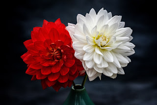
King of flour History of flower cultivation in Gadkhali
গদখালীতে ফুল চাষের ইতিহাস

গদখালী ইউনিয়ন বাংলাদেশের যশোর জেলার ঝিকরগাছা উপজেলার অন্তর্ভুক্ত একটি ইউনিয়ন। এই ইউনিয়ন বাণিজ্যিকভাবে ফুল চাষের জন্য বিখ্যাত।
গদখালী ইউনিয়ন

গদখালী ইউনিয়ন
ইউনিয়ন
দেশ
বাংলাদেশ
বিভাগ
খুলনা

জেলা
যশোর
উপজেলা
ঝিকরগাছা
আয়তন
• মোট
৬৩.৮৪ বর্গকিমি (২৪.৬৫ বর্গমাইল)

জনসংখ্যা (২০১১)
• মোট
৩৬,৮৯২
• জনঘনত্ব
৫৮০/বর্গকিমি (১,৫০০/বর্গমাইল)

সময় অঞ্চল
বিএসটি (ইউটিসি+6)
১৯৮২ সালে প্রথম বাণিজ্যিক চাষ শুরু। বর্তমানে দেশের মোট ফুলের ৭০% উৎপাদিত হয় গদখালীতে। যা থেকে বছরে আয় হচ্ছে প্রায় ৫শ কোটি টাকা। সীমিত পরিসরে রপ্তানিও হয়ে থাকে। ডিসেম্বর-জানুয়ারিতে উৎপাদন বেশি। আর ফেব্রুয়ারিতে বিক্রয় বেশি। এখানে ছয় হাজার চাষী এবং প্রায় ৫০ হাজার লোক সরাসরি ফুল চাষের সাথে জড়িত।
গদখালীতে ফুল চাষের ইতিহাস
গদখালীতে ফুল চাষ শুরু হয়েছিলো কিভাবে তার খোঁজ নিতে গিয়ে সন্ধান মিললো শের আলী সরদারের।
তার দাবি চার দশক আগে তার হাত ধরে এখানে শুরু হয় ফুলের চাষ আর এলাকার ক্ষেতখামার থেকে বিদায় নিতে শুরু করে ধান পাট বা এ ধরণের প্রচলিত শস্য।
তিনি বলেন, "১৯৮২ সালে এরশাদ আমলে এক বিঘা জমিতে রজনীগন্ধা দিয়ে শুরু করেছিলাম। আমার বাবার নার্সারি ছিলো এবং আমি সেখানেই বসে ছিলাম। ভারত থেকে আসা এক ভদ্রলোক এসে পানি চেয়েছিলো।"
"তার হাতে ফুল। তিনি বললেন এই ফুল পশ্চিমবঙ্গে অনেক হয়। তো আমি ভাবলাম পশ্চিমবঙ্গ আর বাংলাদেশের মাটি তো এক। তখনই শুরু করলাম রজনীগন্ধা দিয়ে"।
শের আলী সরদার ও স্থানীয় অন্যদের ভাষ্যমতে এভাবে প্রায় চার দশক আগে ফুল চাষের যে যাত্রা শুরু হয়েছিলো তার এখন বিস্তার ঘটেছে পুরো অঞ্চল জুড়ে। এখন আসছে নিত্য নতুন জাতের ফুল।

Gadkhali Union is a union in Jhikargachha upazila of Jessore district in Bangladesh. This union is famous for commercial floriculture.
Country

Bangladesh
Department
Khulna
District
Jessore
Upazila
Jhikargachha
Volume
• Total
63.84 sq km (24.75 sq mi)

Population (2011)

• Total
36,692
• Population density
560 / sq km (1,500 / sq mi)
Time zone
BST (UTC + 6)
The first commercial farming started in 1972. At present 80% of the total flowers of the country are produced in Gadkhali. From which the annual income is about 500 crore rupees. Exports are also limited. Production is higher in December-January. And sales are higher in February. Six thousand farmers and about 50,000 people are directly involved in floriculture


Sher Ali Sardar was found in search of how flower cultivation started in Gadkhali.
His claim is that four decades ago, he started cultivating flowers here and started saying goodbye to the farms in the area.
He said, "During Ershad's tenure in 1982, I started with Rajnigandha on one bigha of land. My father had a nursery and I was sitting there. A gentleman from India came and asked for water."
"Flowers in his hand. He said this flower is very common in West Bengal. So I thought West Bengal and Bangladesh have the same soil. That's when I started with Rajnigandha."
According to Sher Ali Sardar and other local commentators, the journey of floriculture that began almost four decades ago has now spread across the region. Now new varieties of flowers are always coming.


call or gmail export any country +8801957275909
Monday, August 16, 2021
Land port of Bangladesh
Benapole

Land port of Bangladesh
Benapole is a city in Bangladesh bordering India. Benapole is the main and largest land port in Bangladesh. Benapole Custom House is there to handle the customs activities of this land port. Land Port Authority of Bangladesh conducts land port activities. Benapole, a port city on the Indo-Bangladesh border, is a municipality in Sharsha upazila of Jessore district.
Benapole
Land port
Benapole Benapole is located in Bangladesh
Coordinates: 23 ° 2631 ″ North ৮৮ ′ 53744 ″ East
Country
Bangladesh
Department
Khulna Division
District
Jessore district
Upazila
Sharsha Upazila
Time zone
BST (UTC + 6)
Benapole is one of the leading municipalities in Bangladesh. The current mayor of this municipality is Ashraful Alam Liton. The train between Bangladesh and India runs through Benapole railway station. The part of India opposite Benapole is known as Petrapol. It belongs to Bangaon subdivision of West Bengal. The distance from Benapole to Kolkata in West Bengal is only 60 km.
Edit location
Benapole is a municipality in Sharsha upazila of Jessore district. It has a police station of its own. This police station is known as Benapole Port Police Station.
বেনাপোল ভারতের সীমান্তবর্তী বাংলাদেশের একটি পৌরশহর। বেনাপোলে বাংলাদেশের প্রধান এবং সবচেয়ে বড় স্থলবন্দর অবস্থিত। এই স্থলবন্দরের শুল্ক কার্যক্রম পরিচালনার জন্য রয়েছে বেনাপোল কাস্টম হাউজ। স্থলবন্দরের কার্যক্রম পরিচালনা করে বাংলাদেশ স্থলবন্দর কর্তৃপক্ষ। ভারত-বাংলাদেশ সীমান্তবর্তী বন্দরনগরী বেনাপোল যশোর জেলার শার্শা উপজেলার অন্তর্গত একটি পৌরশহর।
বেনাপোল
স্থল বন্দর
বেনাপোল বাংলাদেশ-এ অবস্থিতবেনাপোলবেনাপোল
স্থানাঙ্ক: ২৩°২′৩১″ উত্তর ৮৮°৫৩′৪৪″ পূর্ব
দেশ
বাংলাদেশ
বিভাগ
খুলনা বিভাগ
জেলা
যশোর জেলা
উপজেলা
শার্শা উপজেলা
সময় অঞ্চল
বিএসটি (ইউটিসি+৬)
বেনাপোল বাংলাদেশের প্রথম সারির একটি পৌরসভা। এই পৌরসভার বর্তমান মেয়র হলেন আশরাফুল আলম লিটন। বেনাপোল রেলস্টেশনের মধ্য দিয়ে বাংলাদেশ-ভারতের মধ্যকার রেল চলাচল করে। বেনাপোলের বিপরীতে ভারতের দিকের অংশটি পেট্রাপোল নামে পরিচিত। এটি পশ্চিমবঙ্গের বনগাঁ মহকুমার অন্তর্ভুক্ত। বেনাপোল থেকে পশ্চিমবঙ্গের কলকাতার দূরত্ব মাত্র ৮০ কিলোমিটার।
অবস্থান সম্পাদনা
বেনাপোল যশোর জেলার, শার্শা উপজেলার অন্তর্গত একটি পৌরশহর। এর নিজস্ব একটি থানা আছে। এই থানাটি বেনাপোল পোর্ট থানা নামে পরিচিত।
Subscribe to:
Comments (Atom)
-
The Padma or Podda (Bengali: পদ্মা Pôdda) is a major river in Bangladesh and India (downstream of Giria). It is the main distributary of th...
-
গদখালীতে ফুল চাষের ইতিহাস গদখালী ইউনিয়ন বাংলাদেশের যশোর জেলার ঝিকরগাছা উপজেলার অন্তর্ভুক্ত একটি ইউনিয়ন। এই ইউনিয়ন বাণিজ্যিকভাবে ফুল চাষে...
-
Benapole Land port of Bangladesh Benapole is a city in Bangladesh bordering India. Benapole is the main and largest land port in Banglad...


